-
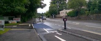
Sleeping PolicemenThis is important because it is dangerous and could be the cause of a dangerous accident and also a great noise disturbance.4 of 100 SignaturesCreated by Craig Gillespie
-
Pay the Roberts family the real value for their propertyNewtown Powys is having a bypass built and the Roberts family have had their home BLIGHTED due to how close the bypass will be once it's built. The property has not been valued correctly and has led to it being undervalued and a very poor settlement being offer. (The family have got an independent local company to value it and it shows that the land agents valuation is extremely low) The family are not asking for anything other than a true valuation of the home. All they are asking is to be treated fair.579 of 600 SignaturesCreated by Kelly Price
-
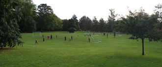
Save Alice ParkAlice Park has very special qualities that are enjoyed by many generations. We recognise that improvement is required and support inclusive developments such as: Installation of an all weather perimeter track. Upgrading of children's play area. Renovation of the tennis courts with one being converted into a multi-sport court for basketball, netball and badminton. Creation of an adventure/wild play area. Installation of an outdoor gym. Repair and maintenance of existing facilities. Restoring and refreshing of flower beds, ponds and gardens.180 of 200 SignaturesCreated by Anna Caron
-
Outrageous-Westminster reverses Fracking refusalThe Government should not interfere, alter, or ride roughshod over the duly elected officials who are there by the people's will.16 of 100 SignaturesCreated by Jk Deeney
-
Save Our BoatyardHistoric boatyard which is part of Tonbridge's history and culture. It provide a haven for wildlife and a green corridor, The boaters are part of the local and wider community2,226 of 3,000 SignaturesCreated by Helen Kirk
-
rowlands castle traffic problemthis is a small village green with a two way traffic flow all round it. massive parking problems, the bus causing gridlock, tempers frayed etc. make it one way, all problems sorted.3 of 100 SignaturesCreated by david groves
-
Re-open Hurst Clough Bridleway, Mottram in LongdendaleIt is important for the safety and well being of horses and riders.398 of 400 SignaturesCreated by lesley cheetham
-
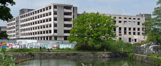
Bristol's Sorting Office: Get it sorted!In 2015 the former Sorting Office on Cattle Market Road, derelict for 18 years and long considered an eyesore, was acquired by Bristol City Council for an estimated £5.4 million. The Council has budgeted up to £2m for the Sorting Office's demolition with “The aspiration...to develop a high quality commercially led, high density mixed use development that re‐imagines this high profile, strategically significant site…”. The public ownership of the iconic former Sorting Office makes it a community asset and affords Bristol a unique opportunity to pursue a development which meets the needs and aspirations of the people of Bristol. By replacing 'commercially led' with 'community led', the site could become a vision worthy of our city, meeting Bristol’s needs as defined not by commercial boundaries alone, but by the community who own it. What kind of developments on this high profile city centre site could really serve the communities of Bristol? Do we need to knock down the building - and spend £2million doing so? Does the site need yet another vacant area of rubble, waiting for commercial interests to redevelop it, like at least five other currently empty sites in the Enterprise Zone have so far failed to do? Rather than commercially-led overpriced flats, half-empty office blocks, and national chain stores; could we see community-led council housing, food production and eating, local shops and makers, learning centres, social enterprise, reuse of resources, renewable energy, sustainable transport, art and performance, beautiful spaces and more? If the people were given a voice in the area’s development, what would we envision? So far, public involvement in determining the future of this publicly owned building and site has been practically non-existent. The council have only consulted on a ‘Spatial Framework’’ for the totality of the Temple Quarter Enterprise Zone, and there has never been a full public consultation on plans for the Cattle Market site itself. As a public asset, shouldn’t we, the community, lead its future? A genuine process of engagement, involvement and collaboration with the city’s residents, community stakeholders, progressive thinkers and academics, would result in a creative, pioneering and shared vision - truly representative of both the progressive nature of our city and its needs. We the undersigned therefore demand that Bristol City Council call a halt to current plans to demolish the Sorting Office, and hold a transparent, participatory and collaborative consultation in order to create a shared, community-led vision for the future of the Cattle Market site, which meets the needs and aspirations of the people of the city. #BristolGetItSorted1,443 of 2,000 SignaturesCreated by Ben Moss
-
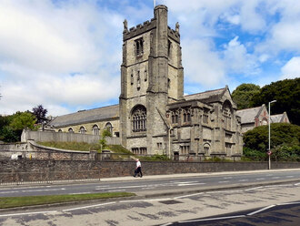
Save St Paul's church, TruroThe basis for demolition rests on the poor structural condition of the church, particularly the tower. The Historic Environment comments accompanying last year's pre-application for demolition confirmed that the building has some cracking but, a recommendation by the structural engineers to monitor the cracks had not been carried out. While stone work, in particular the east end shows some sign of delineation, the Historic England Stone Expert, regarded it not to be the worst case he has seen. The Council's response was that a proposal to demolish the listed church would not be supported on the basis of the incomplete nature of the information and evidence pertaining to its structural condition and the nature and extent of any processes that have or are occurring on site and within the structure. As no additional information has been submitted with the current pre-application we conclude that insufficient information and evidence has been provided to outweigh the substantial harm that would result from the loss of the designated heritage asset and, as such, the demolition cannot be supported. St Paul's church (1848) was extended by J D Sedding in the 1880s in the Perpendicular style using dressed coursed local stone with granite and Polyphant stone dressings; scantle slate and dry Delabole slate roofs with coped gable ends. The church has a six bay aisled nave, south porch at west end. Two bay chancel with organ chamber north of choir, chapel north of sanctuary, tower south of choir, vestry south of sanctuary, brick vaulted crypt underneath the east end. The three-stage embattled tower with angle buttresses has corner statues of Sir Richard Grenville, Sir John Elliott and Bishop Trelawney; three niches (with two carved statues surviving of Christ and St George, St Paul has been removed) to second-stage. Peter Beacham says in the new Pevsner guide (2014) 'the exterior is highly accomplished'. The interior is more modest with six-bay aisles having granite piers with four-centred arches to the north side and round arches to the south. There is some good detailing. The fixtures includes works by the workshops of Robinson of London, and stained glass by Laver, Barraud & Westlake which includes a seven light 'Te Deum' east window in memory of the Mayor of Truro, Sir Philip Protheroe Smith, who died in 1882. It is believed that the stone pulpit to the south side beneath the tower arch came from St Clement's Church and is C15. The oak pulpit has blind ogee tracery and was given to the church in 1901 in memory of Lady Protheroe Smith. The building has a rich history. William Mansell Tweedy, a local banker, paid for the building of St Paul's Church circa 1848 as an overflow church for the parish of St Clements. The architect for the original church is unknown but it consisted of a nave, chancel, south aisle and south porch. In 1864 the church was consecrated and acquired its own parish. In the early 1880s a major programme of extension was undertaken by J. D. Sedding. He replaced the single bay chancel with a much larger structure which included an organ chamber and a chapel, dedicated top St Clement, to the north and a chapel (now the vestry) and the tower to the south. The new work by J. D. Sedding was consecrated in 1884 by Bishop Wilkinson. In 1889 the north aisle, which was probably by Sedding, was completed and the church was re-opened on 27th June 1889. The battlemented tower was completed in 1910 by the architect's nephew E. H. Sedding.3,052 of 4,000 SignaturesCreated by Cornish Buildings Group Cornish Buildings Group
-
Restore democracy to Lancashire [Fracking]We citizens of Lancashire, put politicians in place to represent our needs. We are sovereign, and have the highest form of political authority--you are temporary. Our local council, made up of councillors democratically elected by us, and charged with serving our interests, is exactly the right body to make decisions on local matters. The government have displaced our democracy in Lancashire and we intend to make our vote count next time round. WE THE UNDERSIGNED: PLEDGE TO VOTE FOR NO CONSERVATIVE MP IN THE UPCOMING PARLIAMENTARY ELECTIONS1,043 of 2,000 SignaturesCreated by Gary McMahon

-
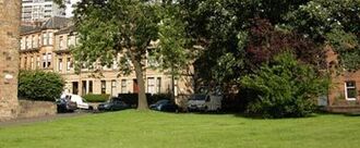
Save the Broomhill Avenue GreenspaceUpdate Unfortunately, despite having a temporary reprieve in January this year, the Greenspace is once again under threat. Glasgow City Council have been again been approached with a proposal to have the land declared surplus and sold for development of flats. Our councillors have been asked to comment on this proposal. The likely outcome of this part of the process is unclear. The more signatures we have on the petition, the stronger the case against that proposal will be, and the more pressure we can place on the City Council to listen to the community, and save the Greenspace for the third, and hopefully final, time. Our much-loved green space on Broomhill Avenue is under threat again - this is a vital green space for families, walkers and dog-walkers to enjoy in the area. If this space goes to be replaced by more housing, this could lead to many families leaving the area in search of accessible green space. (https://www.facebook.com/broomhillavenuepark/) Right now, Glasgow City Council are in negotiations with a developer which could lead to flats being built on our sole green space in the area. Shouldn't Glasgow City Council be preserving this space to help promote physical activity in local communities and be on ongoing legacy from the Commonwealth Games? This is especially sad as in 2008, Glasgow City Council (GCC) promised us that the Broomhill Avenue Greenspace would "be excluded from any future development packages", and assured us that there was no need to officially protect the site as it would be protected under the councils own rules and guidance on open spaces. GCC themselves list the site as part of the "green corridor" which is intended to provide areas for protection of wildlife, which begs the question of why the negotiations over a sale are taking place at all? Although this area is not an official park, it is tended and maintained by local residents and the trees, wildlife and open space are an important part of the community. The space is cared for - residents and children in the community have been working on the site and planted hundreds of flower bulbs, cleaned up rubbish and prepared bird and bat boxes to provide homes for wildlife, with more planting planned coming. All of this hard work is at risk, if the proposed sale goes ahead. We need as many people as possible to hold Glasgow City Council to their promise. Please sign and share our petition to help us protect the site and save a small, but important local resource for the benefit of the residents, wildlife, children and dog walkers who value and appreciate this area. Thank you for your support.996 of 1,000 SignaturesCreated by Chris Osborne

-
Complete the BearsWay projectThe BearsWay project is an important initiative for increasing sustainable transport. It has sadly been shouted down by a small but vocal minority who do not like the changes. They have been reiterating several pieces of misinformation (below), and it seems that the local councillors have been swayed by their rhetoric. Many of the councillors who voted for the amendment which scrapped Phase 2 of the BearsWay did so in opposition to their own parties' sustainable transport policies (Lib Dem and SNP councillors, specifically). Some of the misinformation presented by the opponents to the BearsWay: 1) They claim that the road has been narrowed to an unsafe width, and is difficult to drive on, and that emergency response vehicles are unable to pass cars. Having had discussions with Blue Flag drivers, ROSPA advanced drivers, Driving Instructors, the Police, and Ambulance drivers, there is no evidence to support this assertion. If one drives to the speed limit (30mph), there is no difficulty navigating the traffic calming measures. We suspect that a number of people who used to drive the road at speeds in excess of the limit are angry that they can no longer do so. I have not spoken to an Ambulance Driver who had an issue with the width of the road. 2) They state that a majority of residents are against the proposals. There is no evidence whatsoever for this. There was a petition against the BearsWay which gathered 2,500 signatures, a number of whom are not local. There are 30,000 people local to the area, and 18,000 daily journeys on the road. 3) They complain that cyclists do not use the cycleway provided. This has been measured, and 92% of cyclists use the segregated cycle lane. There are several possible reasons for the minority not using it, including: It is very difficult to enter the cycle lane Northbound, as it requires crossing a busy lane of oncoming traffic, which is particularly difficult during peak times. Some cyclists were unaware of the cycleway, as it is not well signposted. The link from Burnbrae Roundabout to the crossing at MacDonalds is awkward to negotiate, and interrupts the route - it is far more straightforward Southbound to stick to the road for 200 yards until the crossing point moves the cycle lane to the left hand side of the road (and this also holds up traffic less than using the crossing lights) The BearsWay is not finished - the remaining phases would have addressed the issues in getting on to the cycleway safely. 4) The reduced lanes cause congestion. a) There was only ever one lane in each direction - this is the same. b) There is no evidence of increased congestion - the average journey time along Milngavie Road has increased by approximately 1.3 seconds according to a commuter who logged 150 of his journeys.. 5) There was nothing wrong with the road as it was, and therefore no need to change it. Note that 3,000 cyclists are KSI'd (Killed or Seriously Injured) on UK roads each year. This number is rising year on year. These deaths are caused by collisions with motor vehicles, most commonly when a motor vehicle driver violates the cyclist's right of way. Firstly, the old cycle lanes were poorly marked, and often poorly maintained as well; Cars regularly parked in them (they still do on the section from the Burnbrae Roundabout to Milngavie Precinct); Motor vehicles regularly cut into them in order to cut corners; Motor vehicles tended to drive faster than the speed limit. To conclude, a quote from an excellent article (Blog) on the need for change (Source here: http://www.magnatom.net/2016/09/east-dunbartonshire-time-for-change.html) It's not easy of course, because Change never is. It involves making some sacrifices. It means that a road might have to be a wee bit narrower. It means that occasionally you might have to wait behind a bus for 20 seconds. It means that occasionally at junctions, priorities might need to be adjusted. The odd parking space has to be lost! It feels like our liberties are being taken away from us. Are we truly free though? Is having a congestion free dual carriage way Bearsden Road which you can zoom down at 40 mph without impediment in your car really freedom? Only to be stuck in 2 miles of nose to tail traffic on the Switchback Road, which is already dual carriage way, so perhaps we need three lanes each way? What about those that can't drive, perhaps as they are too young, can't afford it, or are not able to through disability. Sure, the bus is one option, but it will never truly provide the freedom that we yearn, by taking us from where we live to where-ever we want to go. It will help to some extent, and is part of the integrated solution, but it is not the whole answer. Freedom only comes when all those who wish to travel, by whatever means they wish, can do it in a way that is safe, comfortable and convenient. As London, and countless other examples demonstrate, if you build it, they will truly come. And they will come with the many, many benefits that having a significant percentage of your populations travelling actively will bring. So I call on the politicians and especially the councillors of East Dunbartonshire to think carefully about the future. Not just their own future, or at the ballot box next year, but for the future of an area I am sure they really do care for. I ask for them to consider that Change, even politically difficult Change is not only desirable, but needed for the area to flourish. Yes there is a strong local voice against it, but then many of them don't want children to have freedom of safe movement. Is that what you and your party stand for? Really? If they choose not to invest in active travel, the area will drown under the weight of the motor vehicle, something that even many of the opponents of the BearsWay agree is an issue. Be on the side of change. Be on the side of a brighter, healthier, less polluted, less congested East Dunbartonshire.3,289 of 4,000 SignaturesCreated by Phil G
Hello! We use cookies to improve your experience by providing insights into how the site is being used. Find out more.


